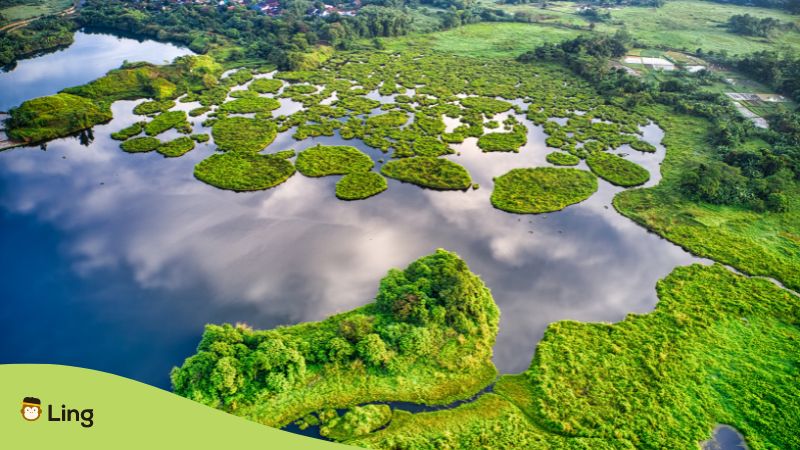
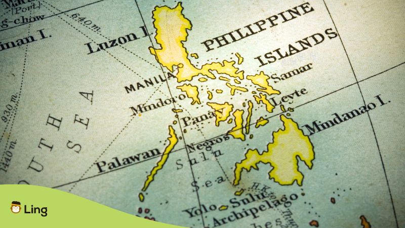
First thing first: Geography in Tagalog is called heograpiya in the Philippines. I know maps sometimes make our eyes glaze over, right? But here’s why the Philippines is different. Forget a single blob of land—we’re talking 7,641 islands, some of which are underwater during high tide!
Beaches, mountains, valleys—a place where you can choose your own adventure. And that wild landscape? It’s not just a backdrop. Come, let’s explore the Philippine geography and learn new Tagalog vocabulary!
Table Of Contents
What Is The Meaning Of Heograpiya In Filipino?
So, where did the Tagalog word heograpiya come from? Turns out, it all started way back in ancient Greece where smart thinkers were obsessed with describing our planet. They mixed the words “gē” (meaning “Earth”) and “graphia” (meaning “writing”), and just like that! “Geography“ was born.
Over time, the word spread across the world, getting tweaked a little in every language to fit how people spoke. And you know what? It became heograpiya in Tagalog! So when we Filipinos say it, we’re part of a super old tradition of wanting to understand this planet we live on.
But the Tagalog translation of heograpiya isn’t just about knowing where stuff is on a map. It’s about mountains, rivers, cities—and how they all work together! It’s also about how we humans shape the land and how the land shapes us back.
There’s even a fancy word for figuring out the Earth’s surface—topography or topograpiya in Tagalog! We’re talking about how high mountains are, the crazy paths rivers take, and why people build cities in certain places.
See why it’s important? Understanding geography in Tagalog or heograpiya can help us plan where to put farms, protect special places, and get ready for stuff like typhoons. It’s the science of our home planet with a Filipino twist!
The Basics Of Philippine Geography In Tagalog
Our borders are constantly shifting. High tide can make islands disappear, while low tide reveals hidden sandbars and tiny islets. Plus, volcanic activity can create new land or drastically change coastlines. The Philippines is a land in motion, which makes it exciting, challenging, and always full of surprises!
Do you want to learn more about Tagalog? I’d recommend using the Ling app! It’s a fun and easy way to learn and master 60+ languages effectively. You can find this language app on Google Play and the App Store. Click the download and install button and use it for free!
Now, Here’s your vocabulary and Philippine geography crash course:
Bundok (Mountain)
Mountains, or mga bundok in Tagalog, are tall landmasses rising sharply above the surroundings, and sometimes even brushing the clouds. They’ve formed slowly over ages as Earth’s giant tectonic plates collide or volcanoes erupt.
Think of the majestic Mt. Apo, our tallest at a breathtaking 2,954 meters (9,692 feet). There, you can trek through lush forests and feel the air crisp and cool before reaching the summit and being rewarded with a view that stretches for miles.
So mountains are just peaks, right? Nope—they’re the backbone of our islands, providing habitats for unique wildlife and influencing the patterns of weather in the Philippines.
Bulubundukin (Mountain Range)
A mountain range or bulubundukin in Tagalog is the grand mountain chains that crisscross our islands. They act like giant shields!
The mighty Cordillera in Luzon, for example, shelters the Ifugao people and their hand-carved rice terraces. To the east, the Sierra Madre, a UNESCO World Heritage Site, acts as a rugged barrier against those powerful Pacific typhoons.
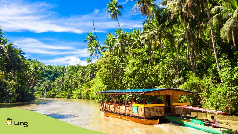
Ilog (River)
Rivers or mga ilog in Tagalog are the lifelines of our islands! The mighty Cagayan River, our longest, cuts an impressive path through northern Luzon, a vital source of life for communities over centuries.
Then there’s Mindanao’s Agusan River. This river snakes through rich biodiversity while countless smaller rivers sustain villages deep within the heart of our islands.
But remember, many islands mean many rivers! The Pasig River runs through the heart of Metro Manila, which is full of history and modern life.
Speaking of history, did you know the term “Tagalog” actually means taga-ilog or “people from the river”? Bet you can’t guess which one! Hint: it flows through the heart of bustling Metro Manila…yes, the Pasig River itself!
Bulkan (Volcano)
A Volcano, or bulkan in Tagalog, happens when Earth’s crust is a little thinner, letting molten rock, ash, and gases burst forth. Volcanoes can be terrifying forces of nature and breathtakingly beautiful at the same time.
Mayon Volcano, with its perfect cone, is legendary for a reason. Taal Volcano in Batangas is doubly unique – a volcano within a lake within another lake (no, that’s not a typo error!
Then there are those with a history of power: Mt. Pinatubo’s 1991 eruption was one of the biggest in the 20th century, while Mt. Kanlaon in Negros is one of our most active, sometimes painting the sky with ash.
Dagat (Sea)
The Philippines is an archipelago—or kapuluan in Tagalog—an island nation. We are literally surrounded by sea or dagat in Tagalog! The South China Sea lies to the west, the Philippine Sea to the east, the Sulu Sea to the south, and the Celebes Sea below.
Yeah, sure, those are just bodies of water, but mind you, they’re teeming with life! Filipino fishermen (and Chinese, Vietnamese, etc..) rely on these seas for their livelihood, while cargo ships navigate busy routes. Incredible creatures like dolphins, whale sharks, and vibrant coral reefs thrive beneath the waves.
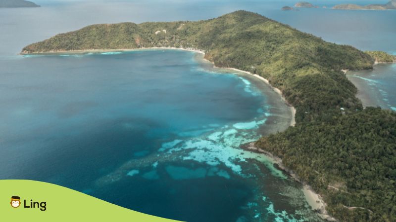
Isla (Island)
Luzon and Mindanao may seem huge, but get ready for this: the Philippines have over 7,600 islands total! Whoa! Some of those are tiny and reveal themselves only at low tide.
An island, or isla in Tagalog, is basically land with water on all sides. Some islands of the Philippines are flat, while others have mountains. We even have a Tagalog word for the smaller island called islets – pulo. You can spot a pulo from a plane, like tiny green dots in a blue ocean!
Others are seriously big, like Palawan, Samar, and Mindoro – they have their own whole provinces and cities tucked inside! Luzon, Visayas, and Mindanao as our big groups of islands, and some of our most famous islands aside from what I mentioned above are Negros, Panay, Leyte, Cebu, and Bohol.
And listen to this: only around 2,000 of those islands actually have people living on them! That’s a lot of hidden beaches and secret ecosystems out there, just waiting to be named and explored.
Kapatagan (Plain)
Plains, or kapatagan in Tagalog, are flat, wide-open stretches of land that are our country’s agricultural powerhouses! They can be vast rice fields or massive fruit plantations. Kapatagan can be nestled in valleys, stretch along coasts, or even sit high up on plateaus.
Ever heard of Central Luzon? That’s our “rice granary,” where provinces like Nueva Ecija, Tarlac, and Pampanga boast seemingly endless plains. Those farmers work incredibly hard to fill our bowls!
But don’t think plains are just for rice. Mindanao has its own fertile wonders! Cotabato and Agusan provinces are known for their huge banana, pineapple, and tropical fruit plantations, which show the incredible diversity of what can grow on a kapatagan.
Burol (Hill)
Burol or hills are smaller, gentler versions of mountains—less tall and less steep. Let’s take the Chocolate Hills of Bohol, for example. It has over 1,700 rounded mounds, which turn a unique chocolatey brown when dry.
Hills are everywhere across our islands, adding curves to the landscape and offering incredible viewpoints. Remember Ligñon Hill in Albay? You climb up, and BAM! Or those lush green rolling hills of Mindoro—they look so peaceful that you could just roll down them and end up on a hidden beach.
Hills come in all shapes and sizes. Some are dotted with trees, and others have that classic grassy look. From the famous ones to the smaller, unnamed hills near your hometown with the best sunset view, they all make the Philippines special.
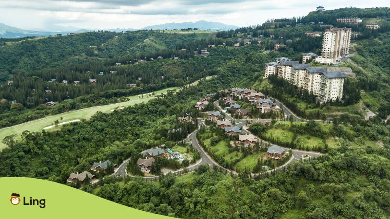
Talampas (Plateau)
Imagine stepping onto nature’s own rooftop balcony. That’s what a plateau or talampas in Tagalog feels like—a flat area high up, with cool breezes and amazing views.
Plateaus form in cool ways: think old volcanoes, slow-motion land rising, or even ancient lava flows. And get this: those cooler temperatures make them perfect for growing stuff you won’t find in the lowlands!
The Benham Rise is a perfect example. It’s a massive underwater plateau—bigger than the entire island of Luzon! Scientists are still figuring out all its secrets, but it could be full of resources.
And it’s not just underwater—smaller plateaus dot our islands. The Bukidnon Plateau in Mindanao, for instance, is famous for its endless pineapple fields and the vibrant Kaamulan Festival, which celebrates the region’s unique cultures.
Lambak (Valley)
Have you ever seen a giant bowl of land sitting pretty between mountains with green fields and bursting with life? That’s a valley, or lambak in Tagalog!
Often, valleys or lambak got rivers snaking through them, making the soil incredibly fertile. Aside from plains, it’s no wonder valleys are our agricultural lands and have been for centuries.
Speaking of powerhouses, the Cagayan Valley in Region II is massive! That place is a whole stretch of land dedicated to rice, stretching as far as the eye can see.
Let’s not forget those smaller, cozier valleys tucked away in the mountains. Think of Baguio, nestled high up with cool breezes, where strawberries and fresh vegetables thrive. Or Tagaytay, with its stunning Taal Volcano views and laid-back vibe.
If you think valleys are just about crops, you’re wrong! They hold entire towns, unique cultures, and sometimes hidden waterfalls or hot springs.
The Three Stars Of The Philippines
You see those three stars on our Philippine flag? Each one is for Luzon, Visayas, and Mindanao—the main parts that make up our awesome archipelago! Ready for a quick tour? Let’s go!
Luzon: Big, Busy, And Full Of Surprises
Luzon is our biggest island, home to bustling Manila. But there’s more! It’s got mountain ranges, volcanoes, and even the Bicol Peninsula—famous for food so spicy it’s like fire!
That’s because the volcanic soil is perfect for growing chilis. And don’t forget those important spots like Lingayen Gulf and Manila Bay—they’ve shaped our history, from trade to everyday life, for centuries.
Luzon’s a melting pot! Echoes of Spanish times are in Vigan’s old houses, while Baguio’s Panagbenga Festival is an explosion of flowers and culture. Ever heard of Ilocano up north or Bicolano down in the peninsula? Each region has its own language, adding to the mix! But of course, English is often used here and even in the whole country.
Visayas: Heart Of the Seas
Visayas is a cluster of islands with sparkling water all around. It’s part of the Coral Triangle, meaning the reefs are crazy colorful and full of life! Samar and Leyte have the San Juanico Strait, which offers panoramic scenic views.
This love of the sea is in their blood! The Dinagyang Festival in Iloilo celebrates their faith and how tough they are against typhoons. Most folks here speak Cebuano, but languages like Hiligaynon (Ilonggo) and Waray-Waray also have their own home regions.
Mindanao: Land Of Promise
Mindanao has it all: mountains, rainforests, and Lake Lanao—big and important for wildlife. Those mountains have kept many unique cultures alive, like the Maranao people’s fantastic art and stories. Plus, Mindanao is where tons of our bananas, pineapples, and other yummy fruits come from!
Languages here are diverse, too. Lots of Cebuano speakers, but you’ll also hear Chavacano, Maranao, Tausug, and even languages of the Lumad tribes up in the highlands.
See what I mean? Which one calls to you most? Is it Luzon’s volcanoes, the Visayas’ chill vibes, or the Mindanao’s mysteries?
Useful Geography Tagalog Vocabulary
Think those Tagalog geography words are just for textbooks? Nope! They can help you find hidden waterfalls, understand why your Lola (grandma) loves living near the sea, and impress your friends. Let me give you more geography terms in Filipino.
Think Like A Geographer, Live Like A Filipino!
See how much cooler bundok sounds than just saying “mountain”? Learning about geography in Tagalog will help you connect to our homeland on a deeper level – understanding how it shaped our delicious food, our festivals, and even the way we talk!
This is just the beginning! The Philippines archipelago holds thousands of secrets waiting to be discovered. Maybe you’ll explore a hidden valley, climb a mountain with your family and enjoy the views that take your breath away, or sail to an island where the people speak a language you’ve never heard. The possibilities are endless!