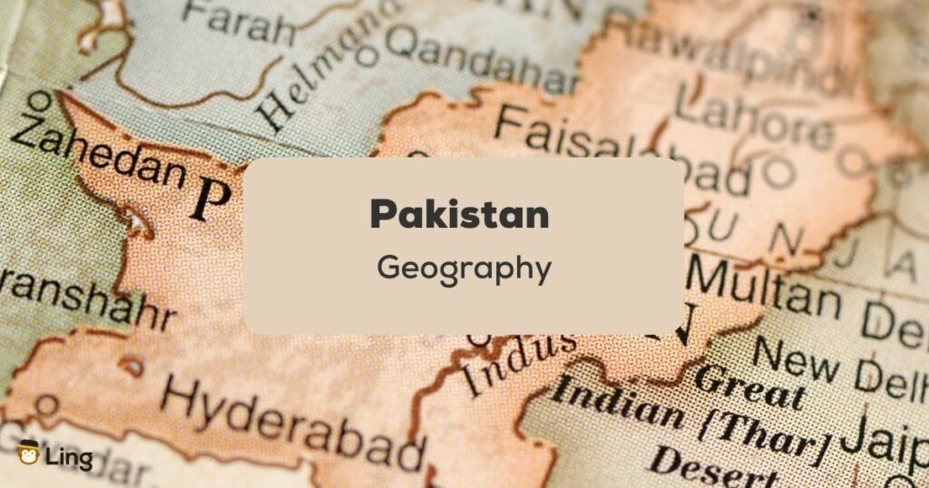
Have you ever taken a look at the Pakistan map ( or نقشہ in Urdu)? Pakistan’s border was drawn between British India to separate Muslim Pakistan and Hindu India. The two countries certainly had a mix of religions, but this divide was inevitable. Let’s read on to learn more about the very interesting Pakistan Geography.
Even after the separation of India and Pakistan, there were many years of trials and disputes. East Pakistan or مشرقی پاکستان (Mashrafi Pakistan) eventually became its nation called Bangladesh. Northern Pakistan or شمالی پاکستان (Shimali Pakistan), on the other hand, has an area that is under dispute with Pakistan and India as well as India and China. It is the home of more significant Kashmir. Let’s learn more about this divide in the sections below!
What Makes Pakistan Geography Beautiful
Pakistan truly has a host of stunning landscapes. It is the home of the Indus river and the Karakoram range. Two national parks opened in 2020, which is a sight to behold. The Gilgit-Balochistan plateau is also breathtakingly beautiful. Here are eight reasons to fall in love with Pakistan!
- Deosai National Park دیوسائی نیشنل پارک: Once nominated for a UNESCO World Heritage status, this “Land of Giants” is also known as “Summer’s Palace” as wildflowers and rare butterflies call it their home around snow-dusted mountains once winter passes.
- Kaghan Valley National Park کاغان ویلی نیشنل پارک: Legends and fairytales mention a story of how the valley was created with the tears of a giant who wept for his fairy. She escaped the giant’s hold with the Prince of Persia. Whether this is true, the clear night skies and alpine lakes certainly make a romantic scene.
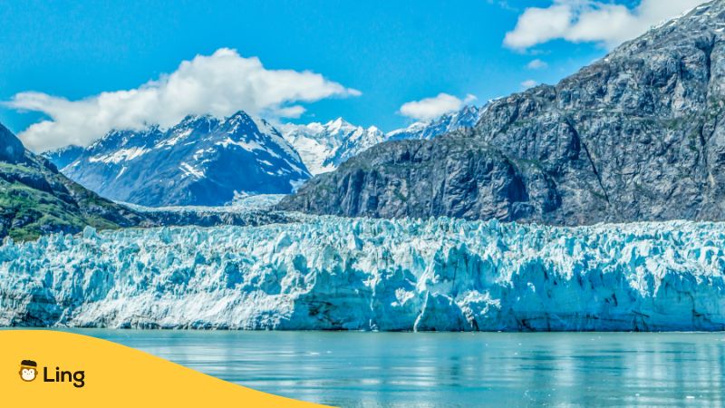
- Hunza Valley وادی ہنزہ: It used to be the resting spot for travelers who would come down the Hindu Kush. The river is aligned with snow-peaked mountains and glaciers. Several animals, like snow leopards, red-striped foxes, and ibexes, can be found here.
- Makran Coastal Highway مکران کوسٹل ہائی وے: The highway invites a most exhilarating long drive covering the Arabian sea coast, Karachi, and through the Iranian border. Several lunar rock formations can also be found at the Buzi pass.
- Hingol National Park ہنگول نیشنل پارک: It is known for its wildlife and active mud volcanoes. It is also a sacred site for Hindus who visit the Hinglaj Temple.
- Neelum Valley National Park نیلم ویلی نیشنل پارک : Located in Azad Kashmir, or free Jammu and Kashmir. The name comes from Pakistan’s federally administering this area as a nominally self-governing entity.
- Arang Kel ارنگ کیل: This is where you can find numerous hiking paths and stunning waterfalls.
- Baltoro Glacier National Park بالٹورو گلیشیر نیشنل پارک: This is one of the world’s largest valley glaciers. A large population of Pakistan depends on the water that melts from the glacier due to water pollution.
- Attabad Lake عطا آباد جھیل: It has beautiful turquoise waters with rocky terrain. A trendy spot to enjoy the serene landscape on a boat.
The Uniqueness Of Pakistan Geography
Towards East Pakistan lies India. At the northwest, it is met by Afghanistan, at the west by Iran, and northeast by China. Talk about how interesting Pakistan’s geography is! The country can be divided into three major regions: the Indus plain, the Northern Highlands, and the Balochistan plateau.
- The Indus Plain سندھ کا میدان
The Indus river basin is highly fertile. It is also one of the world’s greatest rivers flowing from Punjab, India, the Punjab Pakistan Brahmaputra, and the final stretch through Bangladesh. The Indus river plain has an area of over 1 million square kilometers and is a center for agricultural runoff.
- The Northern Highlands شمالی پہاڑی علاقے
Many people have migrated from here from the Makran Coast on the Arabian sea into Pakistan. These areas have harsh climates, and the mountainous geography makes it difficult to travel. The government is selecting some sites to make them hiking destinations.
The mix of northern highlands, southern deserts, and western plateaus gives little agricultural land to Pakistan, and the Sindh people’s area offers much of the fertile ground that feeds Pakistan.
- Balochistan Plateau بلوچستان کی سطح مرتفع
It makes up 48% of the country and is more of a desert landscape. Earthquakes are common in this area, and potable water can only be found near the river. So the population is highest only around there, like the Kharan District.

Learn Urdu With The Ling App
Poor media cause people to fear Pakistan. Its complex history has also made the world assume that Pakistan holds no beauty. But this is far from the truth. From the highest mountain ranges to the lower Indus, Pakistan is truly worth exploring.
While exploring the land, it is also recommended to know the language or at least understand some basics. Urdu, the culture of Pakistan, food, and greetings are nice things to know before visiting.
On the other hand, if you want a more profound experience, dive into Urdu’s beautiful language with the Ling app. The language of Urdu is well known for its enigmatic pattern, and we at Ling can join you in the journey of discovering it.
Ling has over 10 million downloads and over 60 languages in its gamified app. It has an excellent reputation for effective and fun-filled language learning. All the lessons in each language are free and carefully designed to help you with conversations, accents, reading, writing, and listening.
What do you have to lose? Try the Ling app today! Let it be your travel buddy and companion as you plan your trip to Pakistan!